Mitch Blank's North-German Genealogy Site

Let me know if we are researching the same people or places.


Name and place indexes for this entire web site.

Information on just this family and region.

Introduction to this web site.
Copyright ©1998-2017 by Mitch Blank
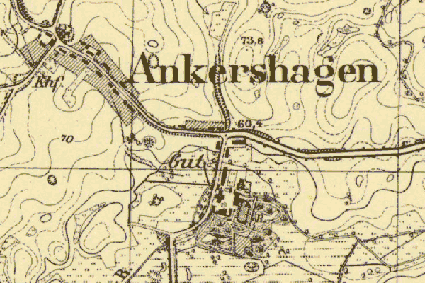
Ankershagen
Kreis Waren, Mecklenburg-Schwerin
Navigation
Let me know if we are researching the same people or places.
Name and place indexes for this entire web site.
Information on just this family and region.
Introduction to this web site.
This page created December 21st, 2008, edited February 24th, 2017
Kreis Waren, Mecklenburg-Schwerin
| |
| To zoom out to a larger area map click here. | |
|---|---|
Map dates from 1884, updated 1911. It covers an area of approximately 1.6 by 1.1 km (1.0 by 0.7 US miles).
Map image was adapted from 1:25K Prussian Landsaufnahme, page 2543